
Carte topographique Shah Khalkar
Carte interactive
Cliquez sur la carte pour afficher l’altitude.
À propos de cette carte
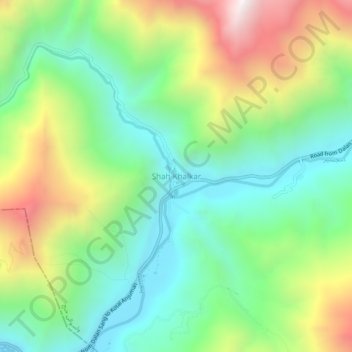
Nom : Carte topographique Shah Khalkar, altitude, relief.
Lieu : Shah Khalkar, ولسوالی خنج, Pandjchir, Afghanistan (35.36577 69.62495 35.40577 69.66495)
Altitude moyenne : 2 457 m
Altitude minimum : 2 019 m
Altitude maximum : 3 252 m
Autres cartes topographiques
Cliquez sur une carte pour visualiser sa topographie, son altitude et son relief.
Vallée du Pandjchir
Afghanistan > Pandjchir > Bazarak
Vallée du Pandjchir, Bazarak, ولسوالی بازارک, Pandjchir, Afghanistan
Altitude moyenne : 2 101 m