
Carte topographique The Municipal District of Kells
Carte interactive
Cliquez sur la carte pour afficher l’altitude.
À propos de cette carte
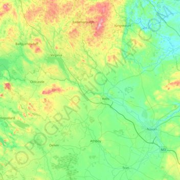
Nom : Carte topographique The Municipal District of Kells, altitude, relief.
Altitude moyenne : 96 m
Altitude minimum : 22 m
Altitude maximum : 329 m
Autres cartes topographiques
Cliquez sur une carte pour visualiser sa topographie, son altitude et son relief.
Rathbane
Rathbane, Moynalty ED, The Municipal District of Kells, County Meath, Leinster, Ireland
Altitude moyenne : 107 m
Scottstown
Scottstown, Rathkenny ED, The Municipal District of Kells, County Meath, Leinster, Ireland
Altitude moyenne : 94 m