
Carte topographique Town of Mount Morris
Carte interactive
Cliquez sur la carte pour afficher l’altitude.
À propos de cette carte
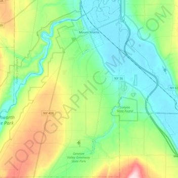
Nom : Carte topographique Town of Mount Morris, altitude, relief.
Altitude moyenne : 267 m
Altitude minimum : 168 m
Altitude maximum : 496 m
Autres cartes topographiques
Cliquez sur une carte pour visualiser sa topographie, son altitude et son relief.
Letchworth State Park
United States > New York > Livingston County > Town of Portage
Letchworth State Park, Town of Portage, Town of Leicester, Livingston County, New York, United States
Altitude moyenne : 357 m