
Carte topographique Billington and Langho
Carte interactive
Cliquez sur la carte pour afficher l’altitude.
À propos de cette carte
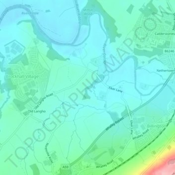
Nom : Carte topographique Billington and Langho, altitude, relief.
Altitude moyenne : 58 m
Altitude minimum : 32 m
Altitude maximum : 187 m
Autres cartes topographiques
Cliquez sur une carte pour visualiser sa topographie, son altitude et son relief.
Old Langho
United Kingdom > England > Lancashire > Ribble Valley > Brockhall Village
Old Langho, Billington and Langho, Brockhall Village, Ribble Valley, Lancashire, England, BB6 8AP, United Kingdom
Altitude moyenne : 74 m