
Carte topographique Veraval
Carte interactive
Cliquez sur la carte pour afficher l’altitude.
À propos de cette carte
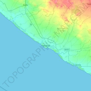
Nom : Carte topographique Veraval, altitude, relief.
Altitude moyenne : 18 m
Altitude minimum : 0 m
Altitude maximum : 125 m
Veraval is located at 20°54′N 70°22′E / 20.9°N 70.37°E / 20.9; 70.37. It has an average elevation of 0 metres (0 feet).