Carte topographique Gokak
Cliquez sur la carte pour afficher l’altitude.
Gokak
Gokak is second biggest city after Belgaum city in Belgaum district and is surrounded by the Western Ghats. The Ghataprabha River, which has water almost throughout the year, is the chief source of agricultural and drinking water for local people living in the surrounding villages. It has an average elevation of 553 metres (1814 feet). The city is situated in the central part of Belgaum district which is located in northwestern parts of Karnataka and lies at the border of two states, Maharashtra in the north and Goa on the west. It is located at a distance of 540 km from Bangalore which is the capital city of the state of Karnataka. Gokak comes under Tropical deciduous moist belt in south central India. Majority of the soil in Gokak taluka is composed of laterite soil and small amounts of black soil is found as well.
À propos de cette carte
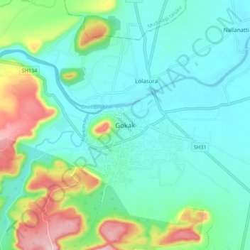
Nom : Carte topographique Gokak, altitude, relief.
Lieu : Gokak, Gokak taluku, Belagavi, Karnataka, 591307, India (16.12930 74.78243 16.20930 74.86243)
Altitude moyenne : 593 m
Altitude minimum : 535 m
Altitude maximum : 768 m
Autres cartes topographiques
Cliquez sur une carte pour visualiser sa topographie, son altitude et son relief.