
Carte topographique Goroka
Carte interactive
Cliquez sur la carte pour afficher l’altitude.
À propos de cette carte
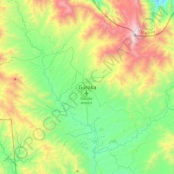
Nom : Carte topographique Goroka, altitude, relief.
Altitude moyenne : 1 890 m
Altitude minimum : 1 088 m
Altitude maximum : 3 513 m
Goroka has a subtropical highland climate (Cfb). Due to altitude Goroka features warm to very warm afternoons and cool to mild mornings year-round, with heavy rainfall most of the year and low rainfall from June to September.