Géolocaliser

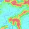
Carte topographique Mapusa

Cliquez sur la carte pour afficher l’altitude.

Mapusa

Mapusa is located at 15°36′N 73°49′E / 15.60°N 73.82°E / 15.60; 73.82. It has an average elevation of 15 metres (49 feet). It lies on the banks of Mapusa River. Mapusa has a tropical climate with temperatures ranging from a high of 37 °C in summer with high levels of humidity to a low of 21 °C in winters.

Wikipedia (CC-BY-SA 3.0)

À propos de cette carte

Nom : Carte topographique Mapusa, altitude, relief.

Lieu : Mapusa, Bardez, North Goa, Goa, 403507, India (15.57962 73.79724 15.62428 73.83535)

Altitude moyenne : 29 m

Altitude minimum : -1 m

Altitude maximum : 110 m

Autres cartes topographiques

Cliquez sur une carte pour visualiser sa topographie, son altitude et son relief.

Mapusa

India > Goa > Bardez

Mapusa is located at 15°36′N 73°49′E / 15.60°N 73.82°E / 15.60; 73.82. It has an average elevation of 15 metres (49 feet).It lies on the banks of Mapusa River. Mapusa has a tropical climate with temperatures ranging from a high of 37 °C in summer with high levels of humidity to a low of 21 °C in winters.

Altitude moyenne : 26 m

Nachinola

India > Goa > Bardez

Altitude moyenne : 19 m

Camurlim

India > Goa > Bardez

Altitude moyenne : 31 m

Assagao

India > Goa > Bardez

Altitude moyenne : 34 m

Verem

India > Goa > Bardez

Altitude moyenne : 18 m

Oxel

India > Goa > Bardez

Altitude moyenne : 20 m

Pilerne Lake

India > Goa > Bardez > Sangolda

Altitude moyenne : 39 m

Revora

India > Goa > Bardez

Altitude moyenne : 18 m

Anjuna

India > Goa > Bardez

Altitude moyenne : 13 m

Moira

India > Goa > Bardez

Altitude moyenne : 14 m

Arpora

India > Goa > Bardez

Altitude moyenne : 16 m

Canca

India > Goa > Bardez

Altitude moyenne : 21 m

Vagator

India > Goa > Bardez

Altitude moyenne : 12 m

Calangute

India > Goa > Bardez

Altitude moyenne : 13 m

Anjuna Beach

India > Goa > Bardez > Anjuna

Altitude moyenne : 10 m

Pomburpa

India > Goa > Bardez

Altitude moyenne : 34 m

Quitla

India > Goa > Bardez

Altitude moyenne : 10 m

Sangolda

India > Goa > Bardez

Altitude moyenne : 30 m

Sircaim

India > Goa > Bardez

Altitude moyenne : 33 m

Marra

India > Goa > Bardez

Altitude moyenne : 27 m

Monte Guirim

India > Goa > Bardez > Parra

Altitude moyenne : 8 m

Sadashivgad

India > Goa > Bardez > Sodiem

Altitude moyenne : 36 m

Monte Guirim

India > Goa > Bardez > Parra

Altitude moyenne : 8 m

Badem

India > Goa > Bardez

Altitude moyenne : 20 m

Mapusa

India > Goa > Bardez

Mapusa is located at 15°36′N 73°49′E / 15.60°N 73.82°E / 15.60; 73.82. It has an average elevation of 15 metres (49 feet).It lies on the banks of Mapusa River. Mapusa has a tropical climate with temperatures ranging from a high of 37 °C in summer with high levels of humidity to a low of 21 °C in winters.

Altitude moyenne : 26 m

Salvador do Mundo

India > Goa > Bardez

Altitude moyenne : 20 m

Mapusa

India > Goa > Bardez

Mapusa is located at 15°36′N 73°49′E / 15.60°N 73.82°E / 15.60; 73.82. It has an average elevation of 15 metres (49 feet). It lies on the banks of Mapusa River. Mapusa has a tropical climate with temperatures ranging from a high of 37 °C in summer with high levels of humidity to a low of 21 °C in winters.

Altitude moyenne : 26 m
Arpora

India > Goa > Bardez

Altitude moyenne : 16 m

Bastora

India > Goa > Bardez

Altitude moyenne : 21 m

Salvador do Mundo

India > Goa > Bardez

Altitude moyenne : 20 m

Canca

India > Goa > Bardez

Altitude moyenne : 21 m

Mapusa

India > Goa > Bardez

Mapusa is located at 15°36′N 73°49′E / 15.60°N 73.82°E / 15.60; 73.82. It has an average elevation of 15 metres (49 feet). It lies on the banks of Mapusa River. Mapusa has a tropical climate with temperatures ranging from a high of 37 °C in summer with high levels of humidity to a low of 21 °C in winters.

Altitude moyenne : 26 m

Marna

India > Goa > Bardez

Altitude moyenne : 41 m

Équipez-vous pour votre prochaine aventure :

🧥Vestes imperméables randonnée - Protection contre pluie et vent en randonnée
🛰️GPS de Randonnée Portable - Appareil de navigation satellite robuste avec cartes préchargées
📟Altimètre de Poche - Appareil dédié à la mesure précise de l'altitude actuelle
🌧️Ponchos de randonnée - Protection pluie légère et compacte
🔌Panneau Solaire Pliable - Source d'énergie autonome pour les treks de plusieurs jours

En tant que Partenaire Amazon, ce site perçoit une commission sur les achats éligibles sans surcoût pour vous.