
Carte topographique Horseshoe Bend
Carte interactive
Cliquez sur la carte pour afficher l’altitude.
Horseshoe Bend
The Horseshoe Bend Airport, FAA identifier is 6M2, is owned and operated by the city. The runway is 4,524 ft. x 60 ft. and is paved.[15] It is located at 36°13′3″N 91°45′3″W / 36.21750°N 91.75083°W / 36.21750; -91.75083 (36.2213694, -91.7554833) at an elevation of 782 ft. / 238 m. Its variation is 03E.[16]
À propos de cette carte
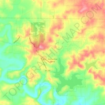
Nom : Carte topographique Horseshoe Bend, altitude, relief.
Lieu : Horseshoe Bend, Izard County, Arkansas, 72512, United States (36.19148 -91.79236 36.26120 -91.68736)
Altitude moyenne : 216 m
Altitude minimum : 160 m
Altitude maximum : 284 m