
Carte topographique Oklahoma City
Carte interactive
Cliquez sur la carte pour afficher l’altitude.
À propos de cette carte
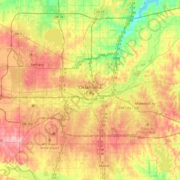
Nom : Carte topographique Oklahoma City, altitude, relief.
Altitude moyenne : 370 m
Altitude minimum : 306 m
Altitude maximum : 432 m
Autres cartes topographiques
Cliquez sur une carte pour visualiser sa topographie, son altitude et son relief.
Lightning Creek Holding Pond B Dam
United States > Oklahoma > Oklahoma County > Oklahoma City
Lightning Creek Holding Pond B Dam, Oklahoma City, Oklahoma County, Oklahoma, 73159, United States
Altitude moyenne : 386 m