
Carte topographique Πηνειός
Carte interactive
Cliquez sur la carte pour afficher l’altitude.
À propos de cette carte
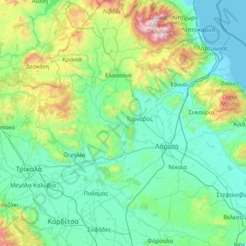
Nom : Carte topographique Πηνειός, altitude, relief.
Altitude moyenne : 409 m
Altitude minimum : -2 m
Altitude maximum : 2 852 m
Autres cartes topographiques
Cliquez sur une carte pour visualiser sa topographie, son altitude et son relief.
Thessalien - Mittelgriechenland
Griechenland > Thessalien - Mittelgriechenland
Thessalien - Mittelgriechenland, Griechenland
Altitude moyenne : 367 m