
Faire un don
Équipez-vous pour votre prochaine aventure :
En tant que Partenaire Amazon, ce site perçoit une commission sur les achats éligibles sans surcoût pour vous.
Carte topographique Snake River
Cliquez sur la carte pour afficher l’altitude.
Faire un don
Équipez-vous pour votre prochaine aventure :
En tant que Partenaire Amazon, ce site perçoit une commission sur les achats éligibles sans surcoût pour vous.
Snake River
Mountain ranges in the Snake watershed include the Teton Range, Bitterroot Range, Clearwater Mountains, Seven Devils Mountains, and the extreme northwestern end of the Wind River Range. Grand Teton is the highest point in the Snake River watershed, reaching 13,775 feet (4,199 m) in elevation. The elevation of the Snake River is 358 feet (109 m) when it joins the Columbia River.[3]
Faire un don
Équipez-vous pour votre prochaine aventure :
En tant que Partenaire Amazon, ce site perçoit une commission sur les achats éligibles sans surcoût pour vous.
À propos de cette carte
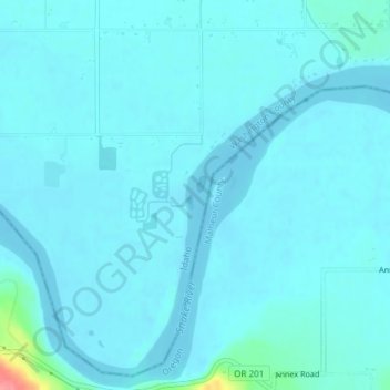
Nom : Carte topographique Snake River, altitude, relief.
Lieu : Snake River, Washington County, Idaho, United States (44.24055 -117.04422 44.24207 -117.04351)
Altitude moyenne : 643 m
Altitude minimum : 635 m
Altitude maximum : 721 m
Faire un don
Équipez-vous pour votre prochaine aventure :
En tant que Partenaire Amazon, ce site perçoit une commission sur les achats éligibles sans surcoût pour vous.
Autres cartes topographiques
Cliquez sur une carte pour visualiser sa topographie, son altitude et son relief.
Midvale
United States > Idaho > Washington County
Midvale is at an elevation of 2,543 feet (775 m) above sea level.
Altitude moyenne : 794 m
Cambridge
United States > Idaho > Washington County
Cambridge is located at 44°34′18″N 116°40′41″W / 44.57167°N 116.67806°W / 44.57167; -116.67806 (44.571535, −116.678013), at an elevation of 2,661 feet (811 m) above sea level. According to the United States Census Bureau, the city has a total area of 0.49 square miles (1.27 km2), of…
Altitude moyenne : 811 m