
Carte topographique Liptovská Teplička
Carte interactive
Cliquez sur la carte pour afficher l’altitude.
À propos de cette carte
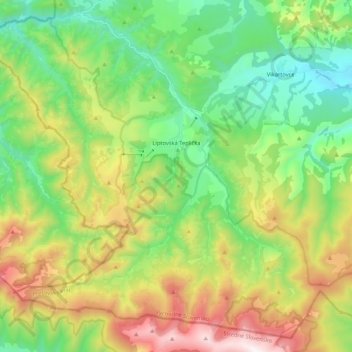
Nom : Carte topographique Liptovská Teplička, altitude, relief.
Lieu : Liptovská Teplička, District of Poprad, Slovakia (48.88920 19.96355 49.01719 20.17566)
Altitude moyenne : 1 139 m
Altitude minimum : 708 m
Altitude maximum : 1 935 m
The municipality lies at an elevation of 919 metres (3,015 ft) and covers an area of 98.69 km² (38.10 mi²). It has a population of about 2270 people.