
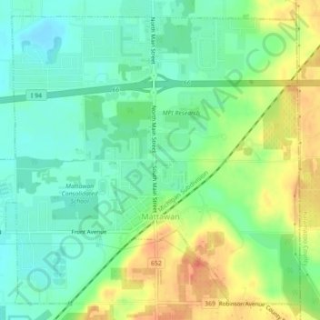
Carte topographique Mattawan
Carte interactive
Cliquez sur la carte pour afficher l’altitude.
À propos de cette carte
Nom : Carte topographique Mattawan, altitude, relief.
Altitude moyenne : 263 m
Altitude minimum : 243 m
Altitude maximum : 294 m
Autres cartes topographiques
Cliquez sur une carte pour visualiser sa topographie, son altitude et son relief.
Lawton
United States > Michigan > Van Buren County > Lawton
Lawton, Antwerp Township, Van Buren County, Michigan, United States
Altitude moyenne : 249 m
Three Mile Lake
United States > Michigan > Van Buren County
Three Mile Lake, Paw Paw Township, Van Buren County, Michigan, United States
Altitude moyenne : 234 m
Hamilton Township
United States > Michigan > Van Buren County
Hamilton Township, Van Buren County, Michigan, United States
Altitude moyenne : 237 m