
Carte topographique Saint-Jean-Baptiste
Carte interactive
Cliquez sur la carte pour afficher l’altitude.
À propos de cette carte
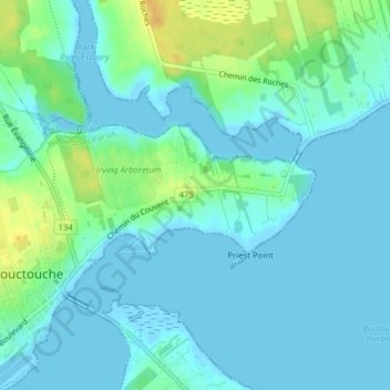
Nom : Carte topographique Saint-Jean-Baptiste, altitude, relief.
Altitude moyenne : 7 m
Altitude minimum : -2 m
Altitude maximum : 27 m
Autres cartes topographiques
Cliquez sur une carte pour visualiser sa topographie, son altitude et son relief.
Bouctouche
Canada > New Brunswick > Bouctouche
Bouctouche, Wellington Parish, Kent County, New Brunswick, Canada
Altitude moyenne : 16 m
Buctouche Harbour
Canada > New Brunswick > Bouctouche
Buctouche Harbour, Rue G.E.Klomfass, Bouctouche, Wellington Parish, Kent County, New Brunswick, E4S 4A5, Canada
Altitude moyenne : 2 m