
Carte topographique Paro District
Carte interactive
Cliquez sur la carte pour afficher l’altitude.
À propos de cette carte
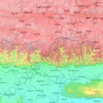
Nom : Carte topographique Paro District, altitude, relief.
Lieu : Paro District, Bhutan (24.90464 86.75834 30.02464 91.87834)
Altitude moyenne : 2 636 m
Altitude minimum : 1 m
Altitude maximum : 8 299 m
Autres cartes topographiques
Cliquez sur une carte pour visualiser sa topographie, son altitude et son relief.
Dopshar-ri Gewog
Dopshar-ri Gewog, Paro District, 12001, Bhutan
Altitude moyenne : 2 829 m
Khangkhu
Bhutan > Paro District > Khangkhu
Khangkhu, Paro Dzongkhag, Paro District, 12001, Bhutan
Altitude moyenne : 2 454 m
Bondey
Bhutan > Paro District > Loong-nyi Gewog
Bondey, Loong-nyi Gewog, Paro District, 12001, Bhutan
Altitude moyenne : 2 402 m