
Carte topographique Pedoulas
Carte interactive
Cliquez sur la carte pour afficher l’altitude.
Pedoulas
Pedoulas (Greek: Πεδουλάς) is a village in the Nicosia District of Cyprus, located at an altitude of 1,100 metres (3,600 ft) in the Troodos Mountains, 4 km south of Moutoullas. It lies in Marathasa Valley. The name is derived from the words pediada (valley) and laos (people). It is popular summer resort.
À propos de cette carte
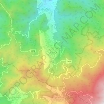
Nom : Carte topographique Pedoulas, altitude, relief.
Lieu : Pedoulas, Nicosia District, Cyprus, 2850, Cyprus (34.94739 32.80877 34.98739 32.84877)
Altitude moyenne : 1 142 m
Altitude minimum : 699 m
Altitude maximum : 1 742 m