
Carte topographique River Cray
Carte interactive
Cliquez sur la carte pour afficher l’altitude.
À propos de cette carte
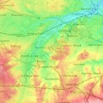
Nom : Carte topographique River Cray, altitude, relief.
Altitude moyenne : 50 m
Altitude minimum : 1 m
Altitude maximum : 110 m
Autres cartes topographiques
Cliquez sur une carte pour visualiser sa topographie, son altitude et son relief.
Darent
United Kingdom > England > Kent > London
Darent, London, Kent, Greater London, England, United Kingdom
Altitude moyenne : 92 m