
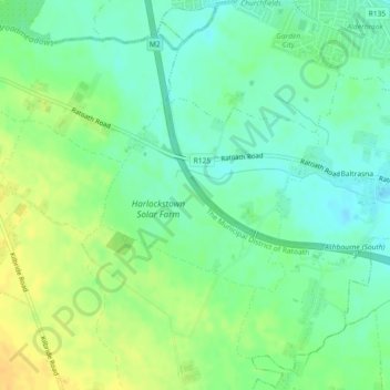
Carte topographique Harlockstown
Carte interactive
Cliquez sur la carte pour afficher l’altitude.
À propos de cette carte
Nom : Carte topographique Harlockstown, altitude, relief.
Altitude moyenne : 73 m
Altitude minimum : 61 m
Altitude maximum : 88 m
Autres cartes topographiques
Cliquez sur une carte pour visualiser sa topographie, son altitude et son relief.
Bettystown
Bettystown, The Municipal District of Laytown — Bettystown, County Meath, Leinster, A92 AH27, Ireland
Altitude moyenne : 6 m
Donore
Ireland > County Meath > Donore
Donore, The Municipal District of Laytown — Bettystown, County Meath, Leinster, A92 VW93, Ireland
Altitude moyenne : 57 m
The Municipal District of Laytown — Bettystown
The Municipal District of Laytown — Bettystown, County Meath, Leinster, Ireland
Altitude moyenne : 72 m
Boyne
Boyne, Kilcooly ED, The Municipal District of Trim, County Meath, Leinster, C15 X3Y2, Ireland
Altitude moyenne : 57 m
Maudlin
Maudlin, Trim Rural ED, The Municipal District of Trim, County Meath, Leinster, Ireland
Altitude moyenne : 61 m
Kells
Ireland > County Meath > Kells
Kells, The Municipal District of Kells, County Meath, Leinster, A82 KD62, Ireland
Altitude moyenne : 70 m