
Carte topographique Irene
Carte interactive
Cliquez sur la carte pour afficher l’altitude.
À propos de cette carte
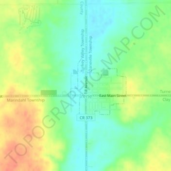
Nom : Carte topographique Irene, altitude, relief.
Altitude moyenne : 432 m
Altitude minimum : 411 m
Altitude maximum : 459 m
Autres cartes topographiques
Cliquez sur une carte pour visualiser sa topographie, son altitude et son relief.
Lesterville
United States > South Dakota > Yankton County
Lesterville, Lesterville Township, Yankton County, South Dakota, United States
Altitude moyenne : 423 m
Sioux Council Boy Scout Reservation
United States > South Dakota > Yankton County
Sioux Council Boy Scout Reservation, Yankton County, South Dakota, United States
Altitude moyenne : 413 m
Yankton
United States > South Dakota > Yankton County
Yankton, Mission Hill South Township, Yankton County, South Dakota, United States
Altitude moyenne : 380 m