
Carte topographique Thal
Carte interactive
Cliquez sur la carte pour afficher l’altitude.
À propos de cette carte
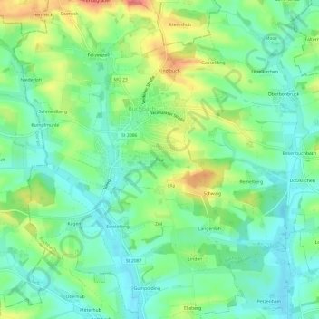
Nom : Carte topographique Thal, altitude, relief.
Altitude moyenne : 454 m
Altitude minimum : 426 m
Altitude maximum : 509 m
Autres cartes topographiques
Cliquez sur une carte pour visualiser sa topographie, son altitude et son relief.
84428
Deutschland > Bayern > Landkreis Mühldorf am Inn > Buchbach
84428, Spaglsöd, Buchbach, Landkreis Mühldorf am Inn, Bayern, Deutschland
Altitude moyenne : 459 m