
Faire un don
Équipez-vous pour votre prochaine aventure :
En tant que Partenaire Amazon, ce site perçoit une commission sur les achats éligibles sans surcoût pour vous.
Carte topographique Mount Pisa
Cliquez sur la carte pour afficher l’altitude.
Faire un don
Équipez-vous pour votre prochaine aventure :
En tant que Partenaire Amazon, ce site perçoit une commission sur les achats éligibles sans surcoût pour vous.
À propos de cette carte
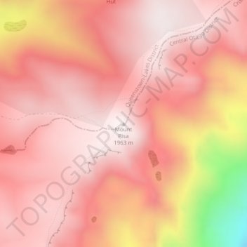
Nom : Carte topographique Mount Pisa, altitude, relief.
Altitude moyenne : 1 739 m
Altitude minimum : 1 055 m
Altitude maximum : 1 959 m
Faire un don
Équipez-vous pour votre prochaine aventure :
En tant que Partenaire Amazon, ce site perçoit une commission sur les achats éligibles sans surcoût pour vous.
Autres cartes topographiques
Cliquez sur une carte pour visualiser sa topographie, son altitude et son relief.
Lac Wanaka
Nouvelle-Zélande > Otago > Queenstown-Lakes District
Le lac Wanaka est un lac de l'île du Sud en Nouvelle-Zélande, située dans la région d'Otago à une altitude de 300 m. Recouvrant 192 km2, il est le quatrième plus grand lac de la Nouvelle-Zélande. Sa profondeur maximale est estimée à 300 m.
Altitude moyenne : 812 m