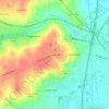
Carte topographique Mobile River
Cliquez sur la carte pour afficher l’altitude.
À propos de cette carte

Nom : Carte topographique Mobile River, altitude, relief.
Lieu : Mobile River, Mobile County, Alabama, United States (30.66568 -88.04237 31.13707 -87.94315)
Altitude moyenne : 32 m
Altitude minimum : -1 m
Altitude maximum : 108 m
Autres cartes topographiques
Cliquez sur une carte pour visualiser sa topographie, son altitude et son relief.


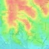

Wilmer
United States > Alabama > Mobile County
Wilmer is located in southwest Alabama northwest of Mobile and near the Alabama-Mississippi border. The community lies on U.S. Route 98 and is two miles northwest of Big Creek Lake. The elevation is 249 feet (76 m).
Altitude moyenne : 67 m


Coden
United States > Alabama > Mobile County
Coden is located at 30°22′59″N 88°14′18″W / 30.38306°N 88.23833°W / 30.38306; -88.23833 and has an elevation of 7 feet (2 m).
Altitude moyenne : 3 m


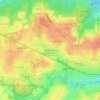

Saint Elmo
United States > Alabama > Mobile County
St. Elmo is located at 30°30′13″N 088°15′15″W / 30.50361°N 88.25417°W / 30.50361; -88.25417. The elevation is 135 feet (41 m). Most of the town lies along U.S. Highway 90.
Altitude moyenne : 41 m


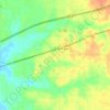
Coden
United States > Alabama > Mobile County
Coden is located at 30°22′59″N 88°14′18″W / 30.38306°N 88.23833°W / 30.38306; -88.23833 and has an elevation of 7 feet (2 m).
Altitude moyenne : 3 m


Coden
United States > Alabama > Mobile County
Coden is located at 30°22′59″N 88°14′18″W / 30.38306°N 88.23833°W / 30.38306; -88.23833 and has an elevation of 7 feet (2 m).
Altitude moyenne : 3 m

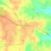
Semmes
United States > Alabama > Mobile County > Semmes
Semmes is located at 30.778N, -88.259W. Elevation is 256 feet. The Semmes area is bounded to the North by the Citronelle area, bounded to the East by the cities of Saraland and Prichard, bounded to the South by the city of Mobile, and finally bounded to the West by Big Creek Lake.
Altitude moyenne : 68 m