
Carte topographique Schauinsland
Carte interactive
Cliquez sur la carte pour afficher l’altitude.
À propos de cette carte
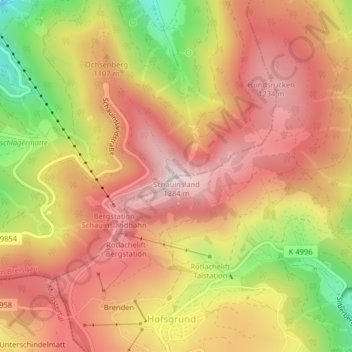
Nom : Carte topographique Schauinsland, altitude, relief.
Altitude moyenne : 1 068 m
Altitude minimum : 740 m
Altitude maximum : 1 279 m
The Schauinsland (literally "look-into-the-country"; near Freiburg im Breisgau, Germany) is a mountain in the Black Forest with an elevation of 1,284 m (4,213 ft) above sea level. It is a popular destination for day trips. Due to the high amount of silver mining, it was previously known as "Erzkasten" (literally "ore box"); the name "Schouwesland" first appeared in 1347. The mountain is located roughly ten kilometres (6.2 miles) south-east of Freiburg's city centre.