
Carte topographique Maasveld II
Carte interactive
Cliquez sur la carte pour afficher l’altitude.
À propos de cette carte
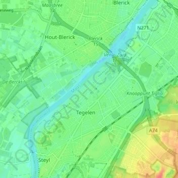
Nom : Carte topographique Maasveld II, altitude, relief.
Altitude moyenne : 24 m
Altitude minimum : 9 m
Altitude maximum : 52 m
Autres cartes topographiques
Cliquez sur une carte pour visualiser sa topographie, son altitude et son relief.
Maasveld I
Nederland > Limburg > Tegelen > Maasveld I
Maasveld I, Tegelen, Venlo, Limburg, Nederland, 5931SG, Nederland
Altitude moyenne : 23 m