
Carte topographique Diavolezza
Carte interactive
Cliquez sur la carte pour afficher l’altitude.
Diavolezza
The Diavolezza is a col and ski resort above the Val Bernina in Graubünden. The col has an altitude of 2,958 metres (9,705 ft) and is located between Munt Pers (northwest, 3,207 metres (10,522 ft)) and Piz Trovat (southeast, 3,146 metres (10,322 ft)).
À propos de cette carte
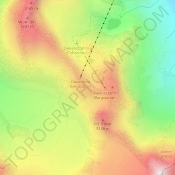
Nom : Carte topographique Diavolezza, altitude, relief.
Lieu : Diavolezza, Pontresina, Maloja, Grisons, 7504, Switzerland (46.41065 9.96701 46.41075 9.96711)
Altitude moyenne : 2 781 m
Altitude minimum : 2 218 m
Altitude maximum : 3 357 m
Autres cartes topographiques
Cliquez sur une carte pour visualiser sa topographie, son altitude et son relief.