

Carte topographique Vrindavan
Cliquez sur la carte pour afficher l’altitude.
Vrindavan
Situated on the west bank of the Yamuna River, about 15 kilometres north of Mathura and 125 km from Delhi, Vrindavan has an average elevation of 170 metres (557 feet). The Yamuna river flows through the city.
À propos de cette carte
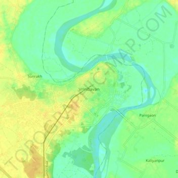
Nom : Carte topographique Vrindavan, altitude, relief.
Lieu : Vrindavan, Mathura, Uttar Pradesh, 281121, India (27.53537 77.65380 27.61537 77.73380)
Altitude moyenne : 172 m
Altitude minimum : 161 m
Altitude maximum : 184 m
Autres cartes topographiques
Cliquez sur une carte pour visualiser sa topographie, son altitude et son relief.
