
Carte topographique Provincia de Chanchamayo
Carte interactive
Cliquez sur la carte pour afficher l’altitude.
À propos de cette carte
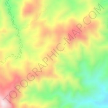
Nom : Carte topographique Provincia de Chanchamayo, altitude, relief.
Lieu : Provincia de Chanchamayo, Perené, Chanchamayo, Junín, Perú (-11.03473 -75.10922 -10.99473 -75.06922)
Altitude moyenne : 1 694 m
Altitude minimum : 1 338 m
Altitude maximum : 2 063 m
Autres cartes topographiques
Cliquez sur une carte pour visualiser sa topographie, son altitude et son relief.
Jose Olaya
Jose Olaya, Perené, Chanchamayo, Junín, Perú
Altitude moyenne : 1 145 m
Catarata Velo de Novia
Catarata Velo de Novia, Perené, Chanchamayo, Junín, Perú
Altitude moyenne : 854 m