
Carte topographique Lake Wahapo
Carte interactive
Cliquez sur la carte pour afficher l’altitude.
À propos de cette carte
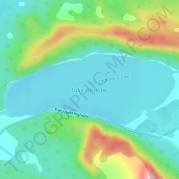
Nom : Carte topographique Lake Wahapo, altitude, relief.
Altitude moyenne : 93 m
Altitude minimum : 42 m
Altitude maximum : 231 m
Autres cartes topographiques
Cliquez sur une carte pour visualiser sa topographie, son altitude et son relief.
Lake Mapourika
Lake Mapourika, Franz Josef Highway, The Forks, Westland District, West Coast, 7886, New Zealand
Altitude moyenne : 139 m