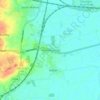
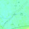
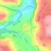
Carte topographique Malton
Cliquez sur la carte pour afficher l’altitude.
Malton
As with the rest of the British Isles and Yorkshire, Malton possesses a maritime climate with cool summers and mild winters. The nearest Met Office weather station for which records are available is High Mowthorpe, about 6 miles (10 km) east of the town centre. Due to its lower elevation, the town centre is likely to be marginally warmer than High Mowthorpe throughout the year.
À propos de cette carte

Nom : Carte topographique Malton, altitude, relief.
Altitude moyenne : 28 m
Altitude minimum : 15 m
Altitude maximum : 91 m
Autres cartes topographiques
Cliquez sur une carte pour visualiser sa topographie, son altitude et son relief.


Harrogate
United Kingdom > England > North Yorkshire
Harrogate is situated on the edge of the Yorkshire Dales, with the Vale of York to the east and the upland Yorkshire Dales to the west and north-west. It has a dry and mild climate, typical of places in the rain shadow of the Pennines. It is on the A59 from Skipton to York. At an altitude of between 100 and…
Altitude moyenne : 106 m




















Bolton Castle
United Kingdom > England > North Yorkshire > Redmire > Castle Bolton
Altitude moyenne : 250 m


Thimbleby & Osmotherly Show field
United Kingdom > England > North Yorkshire > Thimbleby
Altitude moyenne : 152 m








Killinghall
United Kingdom > England > North Yorkshire > Harrogate > Killinghall
Altitude moyenne : 86 m