Géolocaliser

Carte topographique Les Courtils

Carte interactive

Cliquez sur la carte pour afficher l’altitude.

À propos de cette carte

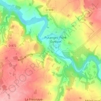
Nom : Carte topographique Les Courtils, altitude, relief.

Lieu : Les Courtils, Putanges-Pont-Écrepin, Putanges-le-Lac, Argentan, Orne, Normandie, France métropolitaine, 61210, France (48.73918 -0.26932 48.77918 -0.22932)

Altitude moyenne : 186 m

Altitude minimum : 119 m

Altitude maximum : 249 m

Autres cartes topographiques

Cliquez sur une carte pour visualiser sa topographie, son altitude et son relief.

Le Chenay

France > Normandie > Orne > Putanges-le-Lac > Putanges-Pont-Écrepin

Le Chenay, Putanges-Pont-Écrepin, Putanges-le-Lac, Argentan, Orne, Normandie, France métropolitaine, 61210, France

Altitude moyenne : 188 m