Géolocaliser

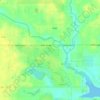
Carte topographique Loxley

Cliquez sur la carte pour afficher l’altitude.

À propos de cette carte

Nom : Carte topographique Loxley, altitude, relief.

Lieu : Loxley, Baldwin County, Alabama, 36551, United States (30.60040 -87.82142 30.73865 -87.64748)

Altitude moyenne : 46 m

Altitude minimum : 12 m

Altitude maximum : 73 m

Autres cartes topographiques

Cliquez sur une carte pour visualiser sa topographie, son altitude et son relief.

Montrose

United States > Alabama > Baldwin County > Fairhope

Altitude moyenne : 17 m

Wolf Creek

United States > Alabama > Baldwin County > Foley

Altitude moyenne : 11 m

Caswell

United States > Alabama > Baldwin County > Orange Beach

Altitude moyenne : 3 m

Ono Island

United States > Alabama > Baldwin County

Ono Island was along the boundary of the treaties between France and Spain. In 1813, after protests and attempts at rebellion, President James Monroe seized Spanish lands west of the Perdido River and declared them a part of the Louisiana Purchase of 1803. This set the east end of the Island, Perdido Key, at…

Altitude moyenne : 1 m

Park City

United States > Alabama > Baldwin County > Daphne

Altitude moyenne : 17 m

Stockton

United States > Alabama > Baldwin County

Altitude moyenne : 20 m

Latham

United States > Alabama > Baldwin County

Altitude moyenne : 31 m

Rosinton

United States > Alabama > Baldwin County

Altitude moyenne : 47 m

Seminole

United States > Alabama > Baldwin County

Altitude moyenne : 13 m

Gulf Shores

United States > Alabama > Baldwin County

Altitude moyenne : 4 m

Park City

United States > Alabama > Baldwin County > Daphne

Altitude moyenne : 17 m

Bay Minette

United States > Alabama > Baldwin County

Altitude moyenne : 72 m

Ono Island

United States > Alabama > Baldwin County

Ono Island was along the boundary of the treaties between France and Spain. In 1813, after protests and attempts at rebellion, President James Monroe seized Spanish lands west of the Perdido River and declared them a part of the Louisiana Purchase of 1803. This set the east end of the Island, Perdido Key, at…

Altitude moyenne : 9 m

Pine Grove

United States > Alabama > Baldwin County

Altitude moyenne : 65 m

Malbis

United States > Alabama > Baldwin County > Daphne

Altitude moyenne : 51 m

Rosinton

United States > Alabama > Baldwin County

Altitude moyenne : 47 m

Bromley

United States > Alabama > Baldwin County

Altitude moyenne : 17 m

Équipez-vous pour votre prochaine aventure :

🔋Batteries externes outdoor - Recharge en autonomie pour GPS et smartphone
🗺️Cartes de Randonnée IGN - Les cartes de référence pour la randonnée précise en France
🚴Compteur Vélo GPS - Suivez vos traces topographiques lors de vos sorties VTT
🧤Vêtements techniques randonnée - Textiles respirants et résistants
🔪Couteau Suisse Officiel - L'outil polyvalent par excellence pour tout explorateur

En tant que Partenaire Amazon, ce site perçoit une commission sur les achats éligibles sans surcoût pour vous.