
Carte topographique Florence
Carte interactive
Cliquez sur la carte pour afficher l’altitude.
Florence
Florence is located in the coastal plain of South Carolina. It is in the northeastern part of the state and the northern part of Florence County. The average elevation above sea level is around 140 ft (43 m). Jeffries Creek is a tributary of the Great Pee Dee River and is the main waterway that flows through the city, passing south of the city center. According to the United States Census Bureau, the city has a total area of 20.9 square miles (54.2 km2), of which 20.9 square miles (54.1 km2) are land and 0.04 square miles (0.1 km2), or 0.22%, is water.
À propos de cette carte
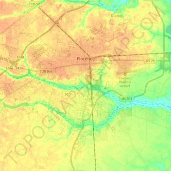
Nom : Carte topographique Florence, altitude, relief.
Lieu : Florence, Florence County, South Carolina, United States (34.11062 -79.87218 34.22983 -79.71702)
Altitude moyenne : 38 m
Altitude minimum : 18 m
Altitude maximum : 49 m