
Faire un don
Équipez-vous pour votre prochaine aventure :
En tant que Partenaire Amazon, ce site perçoit une commission sur les achats éligibles sans surcoût pour vous.
Carte topographique Kingman
Cliquez sur la carte pour afficher l’altitude.
Faire un don
Équipez-vous pour votre prochaine aventure :
En tant que Partenaire Amazon, ce site perçoit une commission sur les achats éligibles sans surcoût pour vous.
Kingman
Kingman is a hamlet in central Alberta, Canada within Camrose County. It is located approximately 27 kilometres (17 mi) north of Camrose and has an elevation of 740 metres (2,430 ft).
Faire un don
Équipez-vous pour votre prochaine aventure :
En tant que Partenaire Amazon, ce site perçoit une commission sur les achats éligibles sans surcoût pour vous.
À propos de cette carte
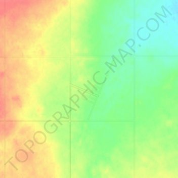
Nom : Carte topographique Kingman, altitude, relief.
Lieu : Kingman, Camrose County, Alberta, Canada (53.19414 -112.77024 53.23414 -112.73024)
Altitude moyenne : 747 m
Altitude minimum : 723 m
Altitude maximum : 773 m
Faire un don
Équipez-vous pour votre prochaine aventure :
En tant que Partenaire Amazon, ce site perçoit une commission sur les achats éligibles sans surcoût pour vous.