
Carte topographique Pulilan
Carte interactive
Cliquez sur la carte pour afficher l’altitude.
À propos de cette carte
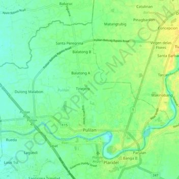
Nom : Carte topographique Pulilan, altitude, relief.
Lieu : Pulilan, Bulacan, Central Luzon, 3005, Philippines (14.88783 120.79772 14.95701 120.89039)
Altitude moyenne : 10 m
Altitude minimum : 0 m
Altitude maximum : 22 m
The municipality is generally of flat topography. Eleven (11) of its barangays are bounded by the Angat River. The rest are flat irrigated rice lands. Soil types vary from sandy loam to clay loam which makes the municipality suitable to a wide range of agricultural products.
Autres cartes topographiques
Cliquez sur une carte pour visualiser sa topographie, son altitude et son relief.
Pulilan
Philippines > Bulacan > Pulilan
Pulilan, Bulacan, Central Luzon, 3005, Philippines
Altitude moyenne : 9 m