Géolocaliser
👉 Easily get elevation data in JSON, GeoTIFF and KML formats using Elevation API
Merci de soutenir ce site ❤️
Faire un don
🎯 Votre prochain emploi est peut-être à un message près : emploichat.fr

Carte topographique Brogborough

Cliquez sur la carte pour afficher l’altitude.

👉 Easily get elevation data in JSON, GeoTIFF and KML formats using Elevation API
Merci de soutenir ce site ❤️
Faire un don
🎯 Votre prochain emploi est peut-être à un message près : emploichat.fr

À propos de cette carte

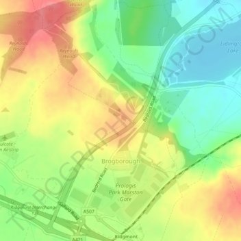
Nom : Carte topographique Brogborough, altitude, relief.

Lieu : Brogborough, Central Bedfordshire, England, United Kingdom (52.02533 -0.61556 52.05194 -0.57951)

Altitude moyenne : 82 m

Altitude minimum : 46 m

Altitude maximum : 121 m

Autres cartes topographiques

Cliquez sur une carte pour visualiser sa topographie, son altitude et son relief.

Flitton

United Kingdom > England > Central Bedfordshire

Altitude moyenne : 70 m

Broom

United Kingdom > England > Central Bedfordshire

Altitude moyenne : 37 m

Dunstable Downs

United Kingdom > England > Central Bedfordshire > Church End

Because of its elevation, Dunstable Downs hosted a station in the shutter telegraph chain which connected the Admiralty in London to its naval ships in the port of Great Yarmouth during the years 1808 to 1814.

Altitude moyenne : 178 m

Chaul End

United Kingdom > England > Central Bedfordshire

Altitude moyenne : 159 m

Campton

United Kingdom > England > Central Bedfordshire

Altitude moyenne : 56 m

Salford

United Kingdom > England > Central Bedfordshire

Altitude moyenne : 82 m

Linslade

United Kingdom > England > Central Bedfordshire

Altitude moyenne : 104 m

Hatch

United Kingdom > England > Central Bedfordshire > Northill

Altitude moyenne : 30 m

Merci de soutenir ce site ❤️
Faire un don
🎯 Votre prochain emploi est peut-être à un message près : emploichat.fr

Ickwell

United Kingdom > England > Central Bedfordshire

Altitude moyenne : 40 m

Tebworth

United Kingdom > England > Central Bedfordshire

Altitude moyenne : 122 m

Beeston

United Kingdom > England > Central Bedfordshire > Sandy

Altitude moyenne : 31 m

Holywell

United Kingdom > England > Central Bedfordshire

Altitude moyenne : 189 m

Merci de soutenir ce site ❤️
Faire un don
🎯 Votre prochain emploi est peut-être à un message près : emploichat.fr

Ireland

United Kingdom > England > Central Bedfordshire

Altitude moyenne : 59 m

Hatch

United Kingdom > England > Central Bedfordshire > Northill

Altitude moyenne : 30 m

Broom

United Kingdom > England > Central Bedfordshire

Altitude moyenne : 37 m

Équipez-vous pour votre prochaine aventure :

🗺️Cartes IGN - Cartes IGN officielles pour randonnée et orientation en France
🔥Réchauds de camping - Réchauds compacts pour cuisine outdoor
🧴Lubrifiant Chaîne Vélo - Entretien pour conditions humides ou poussiéreuses
🎒Sacs de compression - Optimisation du volume dans le sac
🧳Sacs de voyage outdoor - Transport du matériel d’aventure

En tant que Partenaire Amazon, ce site perçoit une commission sur les achats éligibles sans surcoût pour vous.