
Carte topographique Камчатка
Carte interactive
Cliquez sur la carte pour afficher l’altitude.
Камчатка
Like most of its namesake peninsula, the basin of the Kamchatka River has at low altitudes a subarctic climate (Köppen Dfc) with short, cool to comfortable summers and freezing, snowy winters.
À propos de cette carte
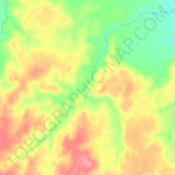
Nom : Carte topographique Камчатка, altitude, relief.
Altitude moyenne : 180 m
Altitude minimum : 146 m
Altitude maximum : 215 m