
Carte topographique Mogok
Carte interactive
Cliquez sur la carte pour afficher l’altitude.
Mogok
At 1,170 metres (3,840 ft) in elevation, the city has a fairly temperate climate year-round, and is home to Bamar, Shan, Lisu, Palaung, and Karen ethnic groups, as well as Chinese, Indians and Gurkhas. The city is composed of two towns, Mogok and Kyat Pyin. Mogok is four miles long and two miles wide. It is situated in a valley surrounded by a large number of mountains. Kyatpyin lies about 7 miles (11 km) southwest of Mogok. Tourists that travel to this area need a special authorization and a guide person.
À propos de cette carte
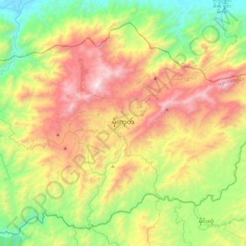
Nom : Carte topographique Mogok, altitude, relief.
Altitude moyenne : 993 m
Altitude minimum : 173 m
Altitude maximum : 2 227 m
Autres cartes topographiques
Cliquez sur une carte pour visualiser sa topographie, son altitude et son relief.