
Carte topographique North End
Carte interactive
Cliquez sur la carte pour afficher l’altitude.
À propos de cette carte
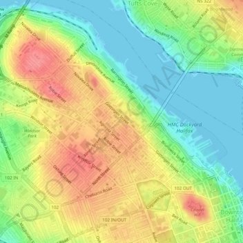
Nom : Carte topographique North End, altitude, relief.
Lieu : North End, Halifax, Nova Scotia, Canada (44.64323 -63.63262 44.67548 -63.58494)
Altitude moyenne : 35 m
Altitude minimum : -2 m
Altitude maximum : 75 m
At 60 m in elevation, Citadel Hill is the highest point on the peninsula and when combined with the expansive undeveloped parkland of the North Common, creates a physical boundary that separates the various neighbourhoods. Fort Needham is another glacial drumlin located in the heart of the North End.