
Carte topographique Konin
Carte interactive
Cliquez sur la carte pour afficher l’altitude.
À propos de cette carte
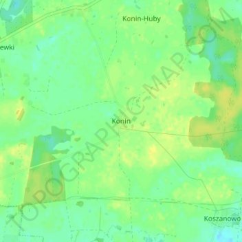
Nom : Carte topographique Konin, altitude, relief.
Altitude moyenne : 100 m
Altitude minimum : 91 m
Altitude maximum : 110 m
Autres cartes topographiques
Cliquez sur une carte pour visualiser sa topographie, son altitude et son relief.
Kaźmierz
Poland > Greater Poland Voivodeship > Szamotuły County
Kaźmierz, gmina Kaźmierz, Szamotuły County, Greater Poland Voivodeship, 64-530, Poland
Altitude moyenne : 88 m
Mokrz
Poland > Greater Poland Voivodeship > Szamotuły County > Mokrz
Mokrz, gmina Wronki, Szamotuły County, Greater Poland Voivodeship, 64-510, Poland
Altitude moyenne : 65 m