
Carte topographique Tambach-Dietharz
Carte interactive
Cliquez sur la carte pour afficher l’altitude.
À propos de cette carte
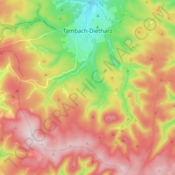
Nom : Carte topographique Tambach-Dietharz, altitude, relief.
Lieu : Tambach-Dietharz, Landkreis Gotha, Thüringen, 99897, Duitsland (50.72402 10.53769 50.80924 10.66008)
Altitude moyenne : 663 m
Altitude minimum : 420 m
Altitude maximum : 883 m
Autres cartes topographiques
Cliquez sur une carte pour visualiser sa topographie, son altitude et son relief.
Gotha
Duitsland > Thüringen > Landkreis Gotha
Gotha, Landkreis Gotha, Thüringen, Duitsland
Altitude moyenne : 320 m
Friedrichroda
Duitsland > Thüringen > Landkreis Gotha
Friedrichroda, Landkreis Gotha, Thüringen, 99894, Duitsland
Altitude moyenne : 495 m