
Carte topographique Vilia
Carte interactive
Cliquez sur la carte pour afficher l’altitude.
À propos de cette carte
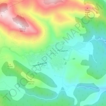
Nom : Carte topographique Vilia, altitude, relief.
Altitude moyenne : 604 m
Altitude minimum : 402 m
Altitude maximum : 978 m
Autres cartes topographiques
Cliquez sur une carte pour visualiser sa topographie, son altitude et son relief.
Psatha
Greece > Attica > Regional Unit of West Attica > Municipal Unit of Vilia > Psatha
Psatha, Community of Vilia, Municipal Unit of Vilia, Municipality of Mandra-Eidyllia, Regional Unit of West Attica, Attica, 190 12, Greece
Altitude moyenne : 79 m