
Carte topographique Claremorris-Swinford Municipal District
Carte interactive
Cliquez sur la carte pour afficher l’altitude.
À propos de cette carte
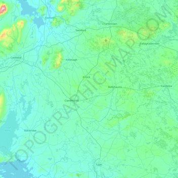
Nom : Carte topographique Claremorris-Swinford Municipal District, altitude, relief.
Altitude moyenne : 69 m
Altitude minimum : 3 m
Altitude maximum : 788 m
Autres cartes topographiques
Cliquez sur une carte pour visualiser sa topographie, son altitude et son relief.
Clare Island
Clare Island, Westport-Belmullet Municipal District, County Mayo, Connacht, Ireland
Altitude moyenne : 29 m
Saleen
Saleen, Hollymount Electoral Division, Claremorris-Swinford Municipal District, County Mayo, Connacht, Ireland
Altitude moyenne : 34 m
Castlebar
Castlebar, Castlebar Municipal District, County Mayo, Connacht, Ireland
Altitude moyenne : 44 m
Craggy
Craggy, Clare Island ED, Westport-Belmullet Municipal District, County Mayo, Connacht, Ireland
Altitude moyenne : 41 m
Ballina Municipal District
Ballina Municipal District, County Mayo, Connacht, Ireland
Altitude moyenne : 74 m
Blowhole
Blowhole, Ballycastle ED, Ballina Municipal District, County Mayo, Connacht, Ireland
Altitude moyenne : 43 m
Castlebar Municipal District
Castlebar Municipal District, County Mayo, Connacht, Ireland
Altitude moyenne : 85 m
Achill Island
Achill Island, County Mayo, Connacht, F28 X018, Ireland
Altitude moyenne : 42 m
Westport
Ireland > County Mayo > Westport
Westport, Westport-Belmullet Municipal District, County Mayo, Connacht, F28 RD39, Ireland
Altitude moyenne : 40 m