
Carte topographique Janggir Leto
Carte interactive
Cliquez sur la carte pour afficher l’altitude.
À propos de cette carte
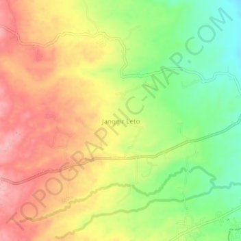
Nom : Carte topographique Janggir Leto, altitude, relief.
Lieu : Janggir Leto, Simalungun, North Sumatra, Indonesia (2.89760 98.97860 2.93760 99.01860)
Altitude moyenne : 593 m
Altitude minimum : 516 m
Altitude maximum : 661 m
Autres cartes topographiques
Cliquez sur une carte pour visualiser sa topographie, son altitude et son relief.
Kebun Teh Bah Butong
Indonesia > North Sumatra > Simalungun > Sidamanik
Kebun Teh Bah Butong, Sidamanik, Simalungun, North Sumatra, Indonesia
Altitude moyenne : 900 m
Pematang Purba
Indonesia > North Sumatra > Simalungun
Pematang Purba, Simalungun, North Sumatra, Indonesia
Altitude moyenne : 1 212 m