
Faire un don
Équipez-vous pour votre prochaine aventure :
En tant que Partenaire Amazon, ce site perçoit une commission sur les achats éligibles sans surcoût pour vous.
Carte topographique Bradgate Park
Cliquez sur la carte pour afficher l’altitude.
Faire un don
Équipez-vous pour votre prochaine aventure :
En tant que Partenaire Amazon, ce site perçoit une commission sur les achats éligibles sans surcoût pour vous.
Bradgate Park
Overlying the Beacon Hill Formation, but found a little further down the hillside to the south, are the Bradgate Formation beds, the most notable of which is the Sliding Stone Slump Breccia rocks. Forming a line of crags below Old John, these are laminated mudstones, with layers of sandstone, mainly of volcanic origin. The beds are substantially warped, contorted and folded. Many of the more intricate folds and 'sag' patterns are thought to have occurred while the sediments were unconsolidated and water saturated. Suggested causes for these include slumping, earth tremors and fault-movements, trapped water or gases and volcanic bomb impacts. Outcrops of other rocks of the Bradgate Formation are found further down the slope. These are younger than and stratigraphically above the breccia, but the uplift from ancient mountain-building, the dip of the beds and erosion of overlying rocks mean that the younger rocks are encountered at progressively lower altitudes.
Faire un don
Équipez-vous pour votre prochaine aventure :
En tant que Partenaire Amazon, ce site perçoit une commission sur les achats éligibles sans surcoût pour vous.
À propos de cette carte
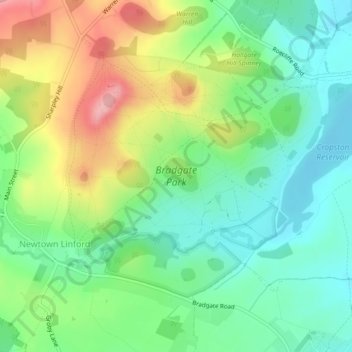
Nom : Carte topographique Bradgate Park, altitude, relief.
Altitude moyenne : 126 m
Altitude minimum : 77 m
Altitude maximum : 209 m
Faire un don
Équipez-vous pour votre prochaine aventure :
En tant que Partenaire Amazon, ce site perçoit une commission sur les achats éligibles sans surcoût pour vous.
Autres cartes topographiques
Cliquez sur une carte pour visualiser sa topographie, son altitude et son relief.
Old John
United Kingdom > England > Leicestershire > Charnwood > Newtown Linford
Altitude moyenne : 143 m