
Carte topographique Koksay (border Kyrgyzstan - Kazakhstan)
Carte interactive
Cliquez sur la carte pour afficher l’altitude.
À propos de cette carte
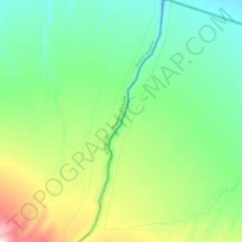
Nom : Carte topographique Koksay (border Kyrgyzstan - Kazakhstan), altitude, relief.
Altitude moyenne : 1 778 m
Altitude minimum : 1 534 m
Altitude maximum : 2 311 m
Autres cartes topographiques
Cliquez sur une carte pour visualiser sa topographie, son altitude et son relief.
Talas
Kirghizistan > Province de Talas > Talas
Talas, Province de Talas, Kirghizistan
Altitude moyenne : 1 251 m