
Carte topographique Clarksburg
Carte interactive
Cliquez sur la carte pour afficher l’altitude.
Clarksburg
Clarksburg is located at the junction of U.S. 50 and U.S. 19, two miles west of the junction of U.S. 50 with Interstate 79. The city lies at an elevation of 1,007 feet at the junction of Elk Creek and the West Fork River of the Monongahela River.
À propos de cette carte
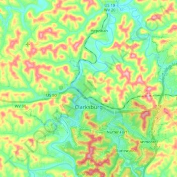
Nom : Carte topographique Clarksburg, altitude, relief.
Lieu : Clarksburg, Harrison County, West Virginia, United States (39.24993 -80.40078 39.33619 -80.24495)
Altitude moyenne : 347 m
Altitude minimum : 275 m
Altitude maximum : 475 m