
Carte topographique Ban Pak Don
Carte interactive
Cliquez sur la carte pour afficher l’altitude.
À propos de cette carte
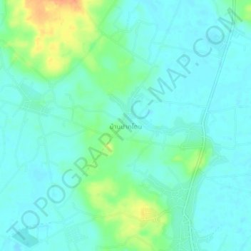
Nom : Carte topographique Ban Pak Don, altitude, relief.
Lieu : Ban Pak Don, Rayong Province, 21190, Thailand (12.67629 101.60178 12.71629 101.64178)
Altitude moyenne : 11 m
Altitude minimum : -1 m
Altitude maximum : 45 m
Autres cartes topographiques
Cliquez sur une carte pour visualiser sa topographie, son altitude et son relief.
Ban Wang Kloi
Thailand > Rayong Province > Ban Pak Don > Ban Wang Kloi
Ban Wang Kloi, Ban Pak Don, Rayong Province, Thailand
Altitude moyenne : 17 m