
Carte topographique Edewecht
Carte interactive
Cliquez sur la carte pour afficher l’altitude.
À propos de cette carte
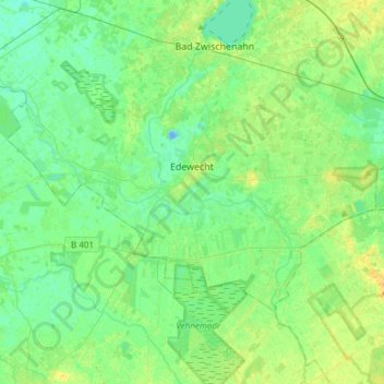
Nom : Carte topographique Edewecht, altitude, relief.
Lieu : Edewecht, Landkreis Ammerland, Lower Saxony, 26188, Germany (53.05953 7.83998 53.17285 8.14158)
Altitude moyenne : 8 m
Altitude minimum : -13 m
Altitude maximum : 22 m
Autres cartes topographiques
Cliquez sur une carte pour visualiser sa topographie, son altitude et son relief.
Bad Zwischenahn
Germany > Lower Saxony > Landkreis Ammerland
Bad Zwischenahn, Landkreis Ammerland, Lower Saxony, 26160, Germany
Altitude moyenne : 9 m
Rastede
Germany > Lower Saxony > Landkreis Ammerland
Rastede, Landkreis Ammerland, Lower Saxony, 26180, Germany
Altitude moyenne : 7 m