
Carte topographique Turracher Höhe
Carte interactive
Cliquez sur la carte pour afficher l’altitude.
À propos de cette carte
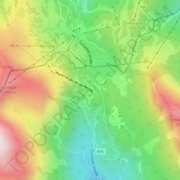
Nom : Carte topographique Turracher Höhe, altitude, relief.
Altitude moyenne : 1 870 m
Altitude minimum : 1 545 m
Altitude maximum : 2 293 m
The highest point of the approx. two km long pass summit has an altitude of 1,795 m above sea level south of the Turracher Lake. The lake has a water level of 1,763 m above sea (Adria) level and is connected to the village. The Turracher Höhe, as a "classic" pass summit, is also part of a drainage divide between the Mura valley and the Upper Gurk River, whose source is beneath the Lattersteighöhe at approx. 2,000 m above sea level.